Monday 23 July 2012

The Dempster Highway

July 23, 2012
Sunrise: 4:10 am
Sunset: 1:43 am
Temps: 11 - 25'C

The fun-mobile    


At the Tombstone Park Interpretive Center


The Tombstone Range


Nap time


Looking West
Entering the Arctic circle
Caribou in the distance, on the ridge. We saw about 1000 of the Porcupine Caribou herd. So lucky!!

Waiting for the broken ferry, eating quality "local" bread.

The ferry and the sophisticated cable repair kit


Husband and wife reunite!

July 23, 2012
Sunrise: 4:10 am
Sunset: 1:43 am
Temps: 11- 25 'C


NEWS! The Inuvik Post hath received notice that the newly wedded couple, gold baron Mister N. Kurtz and bar wench L. Luppens, were recently reunited in Dawson City, Yukon. Rumour hath it that they lodged at Klondike Kate's cabins, dined at the Drunken Goat and frequented the gambling hall, where they were entertained by Diamond Tooth Gertie and her showgirls.

They are pictured here, right, prior to their evening excursion.


Ahem.

So, Natou drove North, Lise flew South, and we met in the quaint little town of Dawson City. Aside from knowing it was a gold rush town, we knew little of the place before our visit, and we had fun exploring this little tourist mecca.


History meets lattes and boutique stores in this well-preserved little town. Buildings are maintained in the olde style, with fake fronts and a multitude of finishing details. Most streets continue to be gravel and mud, and wooden boardwalks remain. Numerous historical exhibits allow for a more detailed look into the past, with pictures from the late 1800s, when Dawson was busting at the seams with prospectors, merchants, riverboats and tents.


Near the confluence of the Klondike and Yukon Rivers, this "Town of the City of Dawson," is home to about 1,319 residents, but sees about 60,000 visitors each year. There certainly are a lot of visitor attractions!


On our way out of town, we stopped by "Dredge #4," a National History Site of Canada. This monster is being refurbished, but was once one of many dredges altering the landscape, sifting through the gold bearing gravel of the local creeks. With buckets weighing over 2 tonnes each, over 60 in number, it is hard to fathom that this engineering marvel is almost 100 years old. These dredges created the curious-looking tailing piles that still characterize Dawson City.


For more info, see:

http://en.wikipedia.org/wiki/Dawson_City
and:

http://www.dawsoncity.ca/


A trip to Deline

On the shore of Great Bear Lake
July 23, 2012
Sunrise: 4:10 am
Sunset: 1:43 am
Temps: 11- 25'C


In early July, I went on "duty travel" to the little community of Deline (Deh-lynn-eh), on the South Western arm of Great Bear Lake.  It is near the Great Bear River, which flows into the Mackenzie River. This is in the Sahtu region.

A collection of caribou antlers
 

To get there, I flew Canadian North (big plane) to Norman Wells, a small community along the Mackenzie River. From there, it was a little flight with a little Northwright plane and two cowboy pilots, landing on the dusty gravel runway in Deline.

This quiet community is home to about 565 Dene First Nations and Metis peoples. I was pleasantly surprised to hear a lot of the local language, North Slavey, spoken amongst both young and old residents of the village.

 My work kept me busy during the day, but one evening I found the time to explore the town. The weather was gorgeous, and a bit of wind kept the NWT bugs at bay. Half the town has waterfront property, and the rest have views of the lake anyways. A few people were fishing off the dock, catching greyling, and young people were cruising by on quads, smiling and kicking up dust. Others drove by in big pick-ups - many had kids in the box and toddlers on their laps. A pretty relaxed town!

Not far into my walk, I noticed a tipi! Thrilled, I took a picture. It appeared to be a mixture of wood and canvas, and I assumed it was a smoke house. A passing elder, who just finished filleting fish, confirmed this. Happy to have noticed this (we don't have tipis in Terrace or Inuvik), I continued on.


And then I saw another tipi. And another. And another. There were tipis everywhere!!

Turns out, Deline is tipi-town. Every second house seems to have one. Heck, they have a church in the form of a tipi.


One of the town's administration buildings is shaped like a tipi. The sign on one of the buildings has a tipi. Even the dog houses are shaped in tipis (no, just kidding!).

Anyways, I really enjoyed my visit to Deline. The people are friendly and laugh easily, and the location is beautiful.


Sunday 8 July 2012

Hot summer days


Sun past midnight
July 8th, 2012
Sunrise: N/A
Sunset: N/A
Temps: 21 - 27'C


So, what is summer like in Inuvik?  
Moving up here, I certainly did not think that I would spend so much of my time in the Arctic being TOO hot! Bright, warm summer days have been my experience thus far, and I have had to explore a few avenues to cope with the heat and the light.


 A popular and particularly classy adaptation involves copious amounts of tinfoil and/or cardboard. When I first came to town, I remember noting many tinfoil-clad windows and scoffing this unsightly modifcation. Ahem. It turns out that this is a cheap and highly effective way to to deal with heat and light, and I have had to resort to this measure to prevent the temperatures in my apartment from routinely climbing above 30'C.

Fortunately my windows can still open to the outside so, no, I am not living in a dark hobbit hole.

Warm sunny summer days and nights also yield unique Northern activities, such as Inuvik's annual "Midnight Sun Fun Run." This popular event includes a 5km, 10km and 21km runs. The start times are staggered allowing most people to arrive at the finish line between 12:00 and 1:00 am.The great runner that I am, I struggled through the 5 km and am pictured here, red faced and sweaty, at the finish line.

Another wonderful thing about Inuvik in the summer is the variety of celebrations and free food events. Inuvik likes to feed people! Pictured here is a view of the Aboriginal Day events on June 21st.
Another reality of warm summer days, especially in this dry climate, is forest fires. (Yes, there are trees in the Arctic!) We have recently had several forest fires within close proximity to town, and with an unfortunate shift of the wind, residents have found themselves scrambling to close windows to keep the smokey air out.


Greenhouse Update

My plot in May
July 8th, 2012
Sunrise: N/A
Sunset: N/A
Temps: 21 - 27 'C

I promised you an update of what's happening at the Inuvik Community Greenhouse. Less than 2 months ago, plots lay bare, and only a few ambitious members had started preparing their soil for the growing season. You may recall the picture of my plot at that time (right).


My plot in early July


Many weeks of continuous 24 hour sunlight later, we have a lot of growth in the greenhouse! Members have been enjoying a variety of fresh herbs, and green leafies of all sorts: kale, chard, spinach, lettuce, beet greens. I have a bit of an overabundance actually, and have already had to resort to blanching and freezing some of the crop.


A very full and busy greenhouse!


A cool day in the greenhouse - some days it hits 40'C!!

A ginormous set of sunflower plants!!

Wednesday 4 July 2012

Ivvavik National Park (Part 1)


The Firth River
July 4th, 2012
Sunrise: n/a
Sunset: n/a
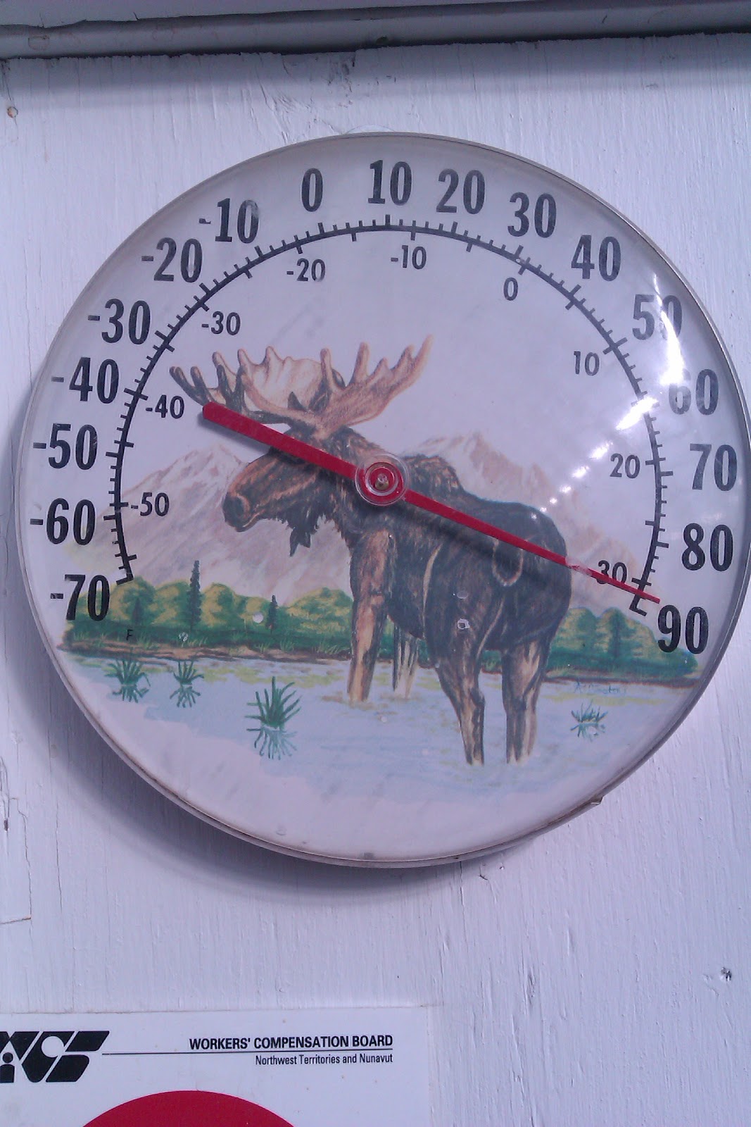
Temps: 17 - 24'C (although lately it's hit the low thirties on numerous days!)

I hummed and hahhed about it for quite a while. It's expensive. Very. But how else does a girl get access to the "local" national parks in the NWT or Yukon? Really, it's a once in a lifetime opportunity.

Alright, alright. So, I bit the bullet. I went.

Our plane, at the airport in Inuvik


Ivvavik National Park in the northern Yukon. 200 km West of Inuvik. Pretty much only accessible by plane. Calving grounds of the Porcupine Caribou herd (have you read "Being Caribou?"). Unglaciated terrain, meaning cool landscapes, rock formations, unique flora and the "oldest" rivers in the world." All in all, a pretty special place with lots to brag about.


The Mackenzie River Delta - lake, lake, river, lake....


We left Inuvik on our chartered flight, crossed over the massively wide Mackenzie River Delta, and entered into the British Mountains. Our little plane landed on the gravel and rock landing strip near the confluence of Sheep Creek and the Firth River, and we set up camp for 5 days

.


Wild flowers in wild lands


Each day was filled with hikes, along alpine ridges and scree slopes, along the creek and the river, and over tussocks and flowering meadows. I found the landscape really interesting, different from what I have seen before, and I was in awe of the hardy little flowering plants that made their home in such extreme terrain. The air was filled with the scent of a fuschia coloured flower, which blossomed in such abundance in the meadows that the hills looked pink from miles away.


Our camp below and the confluence on the left

We were lucky with the weather. In the mornings it would be warm and calm, and I would find good use for my new fashion-forward bug hat. But soon a wind would pick up, keeping us cool and mostly bug free for the majority of the day. Lucky for us, there was also a little mini canyon on Sheep Creek that provided an excellent swimming hole for us at the end of each sweaty hiking day, and that provided a much needed, and very refreshing, daily cleanse.


Working on dinner


Evenings were pretty relaxed. Some members of the group would fish in the Firth River, and I took part in several meals of fresh greyling and dolly varden char (yum!).

While we were too late to witness the caribou migration, their mark on the land was obvious with many long, crisscrossing trails. We did have luck with the sheep, and they were often spotted on the hill near our camp, and even wandered through camp a time or two.


Sheep Creek International Airport


On Canada Day, we awoke to an awesome display of crashing thunder and pouring rain. Things cleared up enough for our plane to come in, and we left the park via the Firth River valley, out over the coastal plain, along the Beaufort Sea, and back over the delta to Inuvik.


From the plane


I will hopefully get additional pictures from fellow park visitors and will post more when I can.


For the "Being Caribou" film check out: http://www.necessaryjourneys.ca/beingcaribou/